

This trail runs from the popular basecamp at Landmannalaugar, across the highlands, over a saddle between two glaciers, and down along the Skogar River, which is home to dozens of the most scenic waterfalls you will ever see. July 1 - 4, 2022. This adventure was so majestic I need to split it into a few sections.
Day 4: 13.6 miles
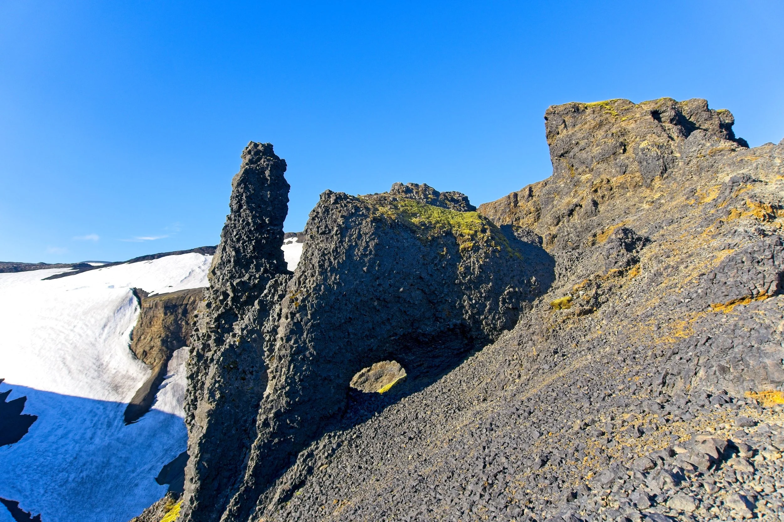
Cowboy camping in a cave, in the side of a mountain, right below two glaciers, certainly ranked in my Top 5 Campsites of all time. As much as I wanted to enjoy it awhile longer, I knew I had a long hike ahead if I wanted to catch the 4pm bus back to Reykjavík. The greenery yielded to the craggy volcanic wasteland as I got higher up and then you could see the two glaciers flanking in from the sides. At the far end of the tabletop was a skinny strip of land, known as Heljarkambur (Hell’s Ridge) connecting it to the saddle. There were chains bolted into the wall to aid hikers in the scramble up the south side. It was sketchy. I loved it. I am sad that I lost this GoPro footage. I climbed up. One of the stakes bolted into the rock that holds the chains in place just popped right out.


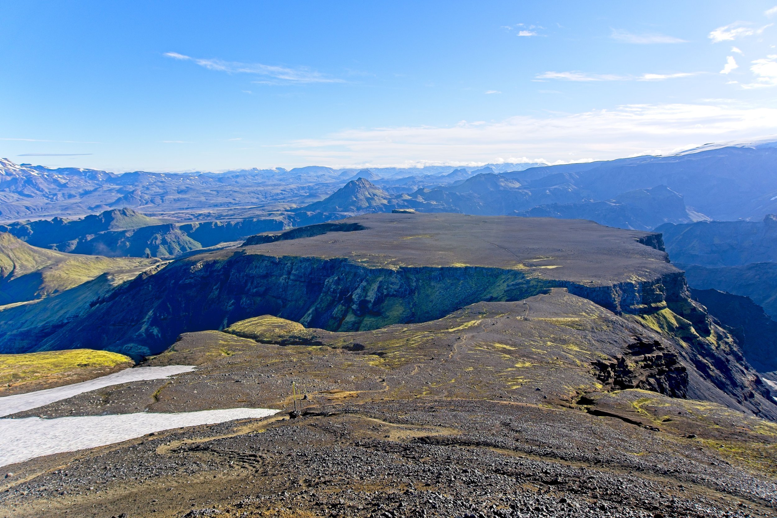

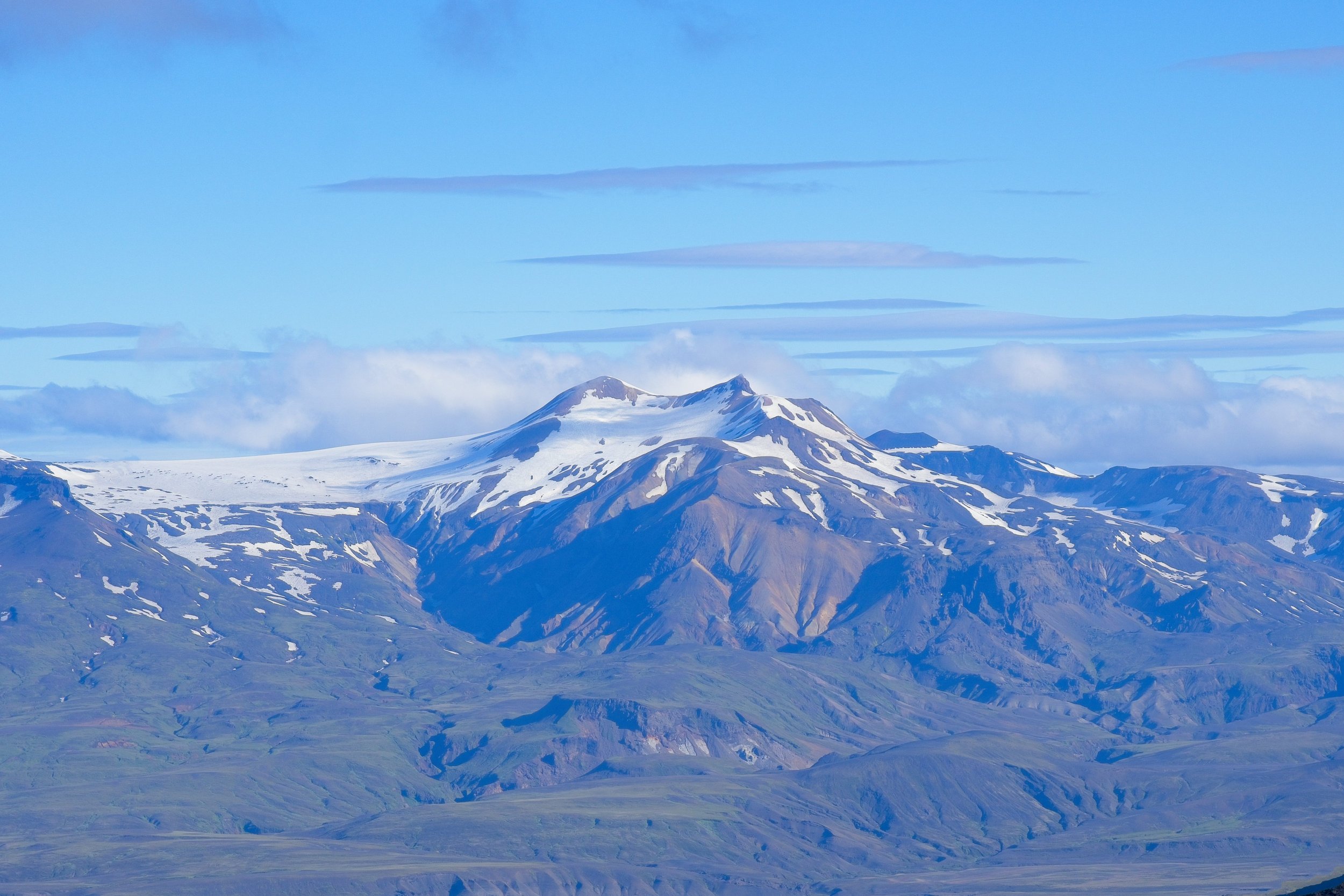
I arrived at Módi and Magni, two baby volcanos that were born in 2010, and I thought that Magni was the high point along this entire trail. When I hiked up to the top, I could see Midsker just ahead and it looked a bit taller, so I decided to go there to enjoy my summit beer that I had been carrying for 40-something miles. This whole saddle, sandwiched between the glaciers of Eyjafjallajökull and Mýrdalsjökull, was insanely beautiful! Like it it had snowed on Mars, except you could also see the ocean.


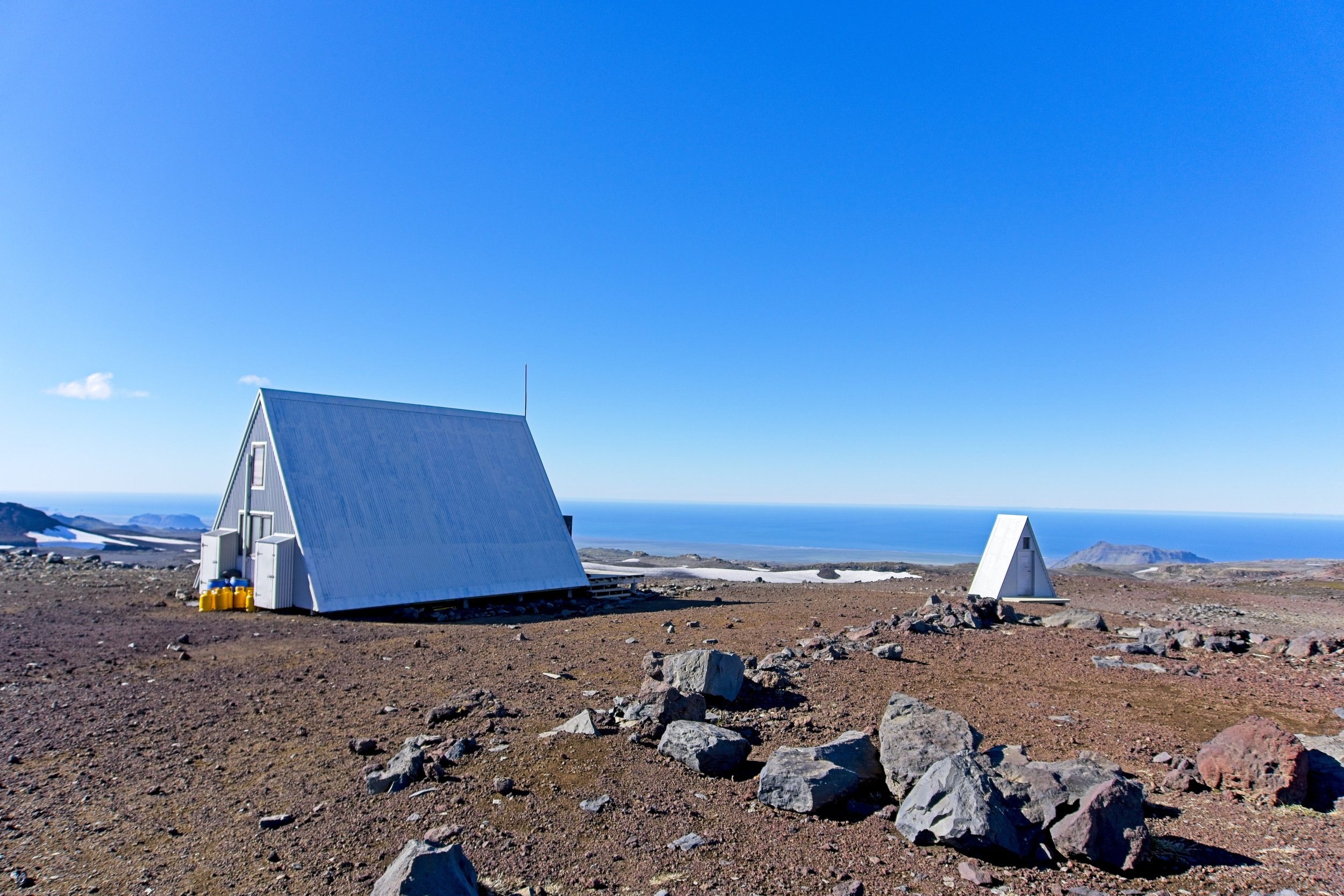
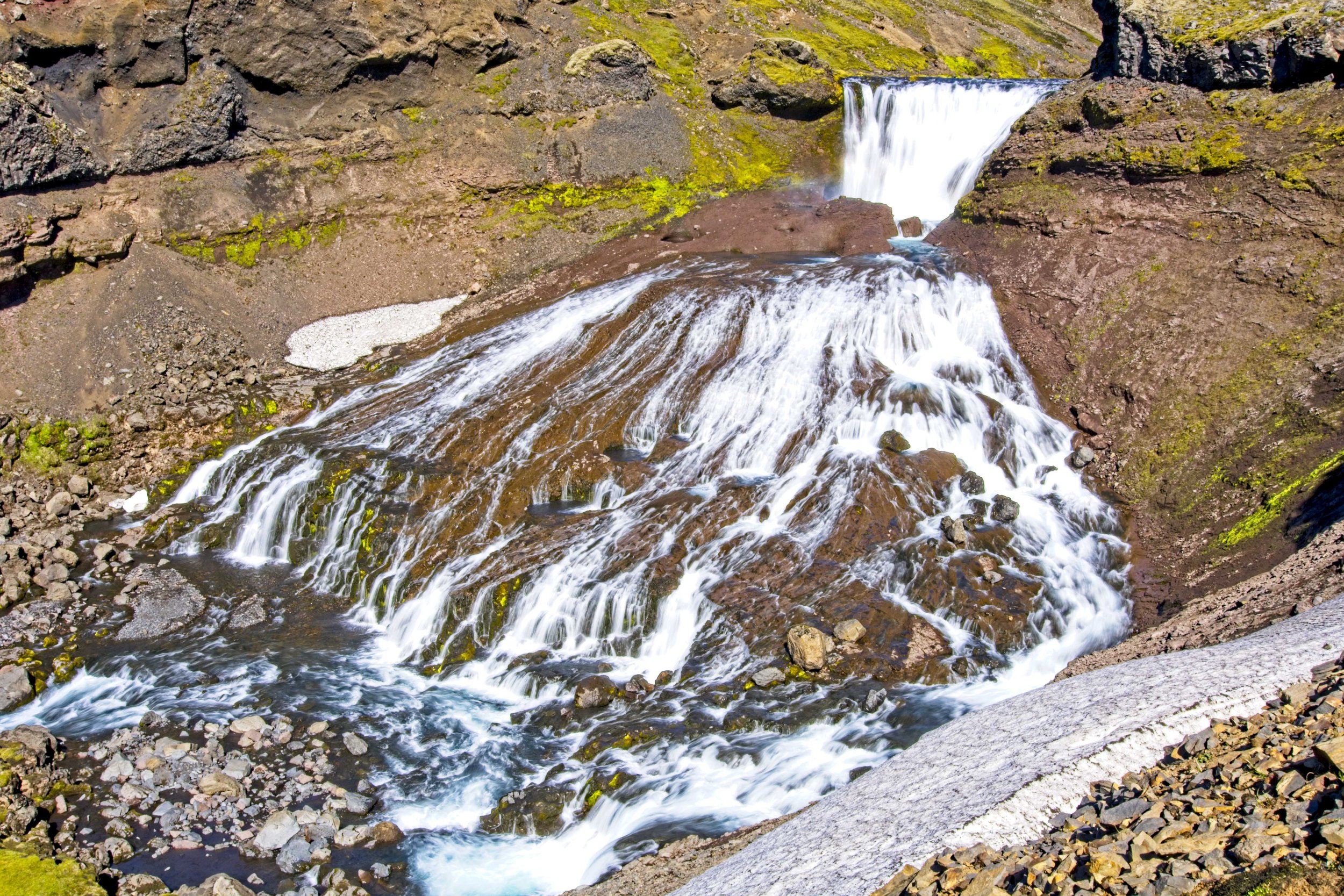
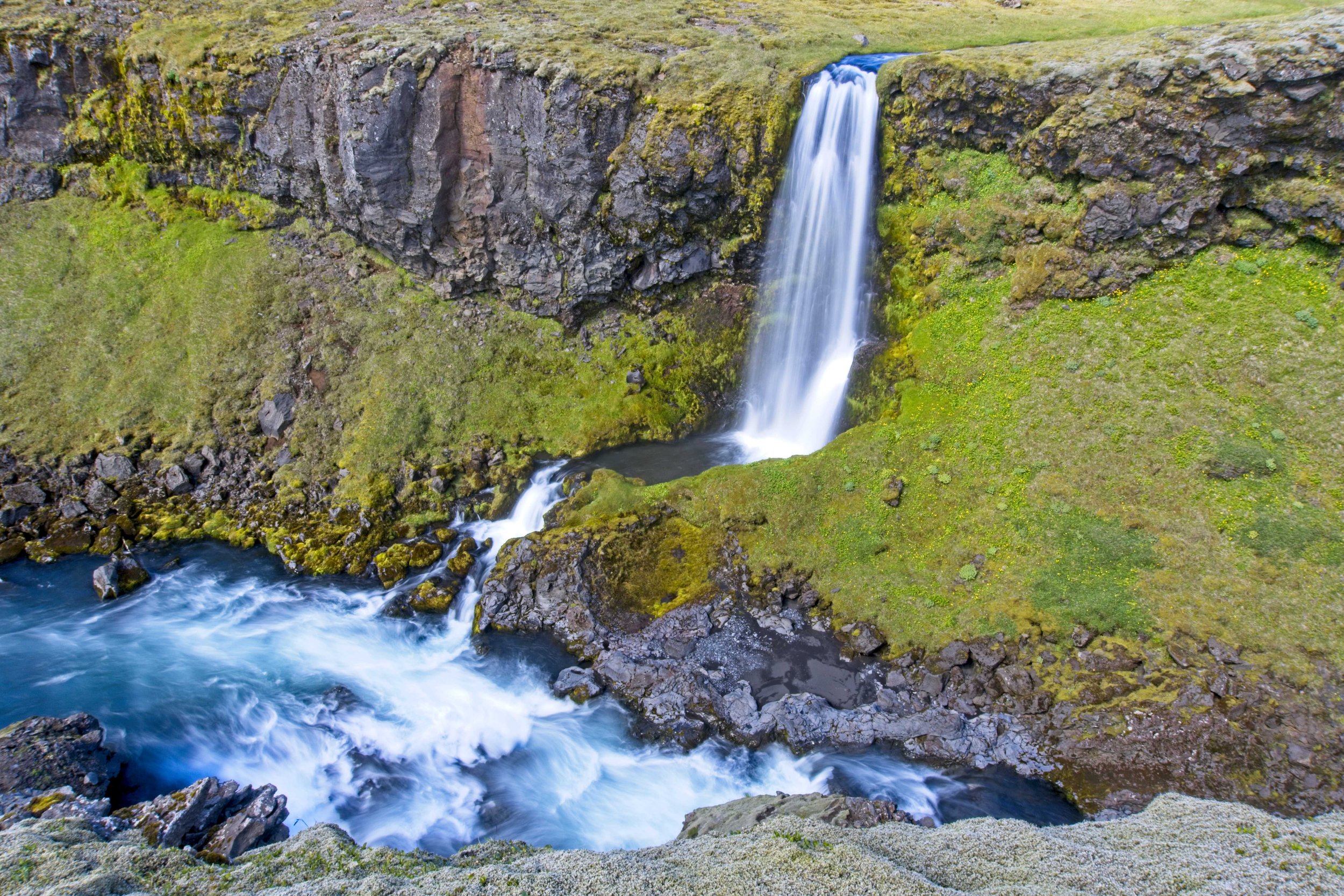
I bounded down the steep and sandy hill and took a food break on the porch of the Baldvinsskalí Hut. I noticed there was an alternate route further to the West and it contained a few bonus waterfalls, so I asked the caretaker about it and she said she always takes that route when she has to go to the bottom for supplies. I was blown away by the first falls. Easily one of the prettiest I have ever seen. And my list of top falls got a new top 3 every 20 minutes for the next few hours. The trail follows the Skogar River and this stretch is called “Waterfall Way” because it is home to no less than a down falls over 100ft tall with massive boulders strewn about, moss covering the walls of the deep canyon, and the light was hitting just right to give many rainbows. Many of these shots are in my Waterfalls of Iceland Calendar!


Alas, I arrived at Skogafoss, jam packed with tourists fresh off the buses. The line to walk down the stairs to the base of the falls was aggravatingly slow, pure nightmare fuel. I took some photos at the bottom, the finish line of my journey, and then decided to go for a swim. The water was freezing cold but I figured I could use a rinse to get four days of hiker stank off of me before hoping on the bus. I found the bus stop and sat down with the other grizzled hikers and shared stories of our journeys over the past few days.

A double rainbow greeted me at the finsih line!